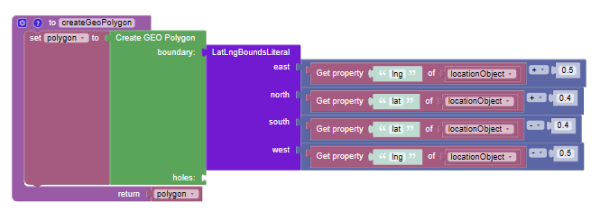
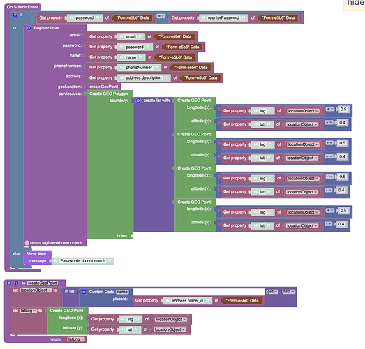
What am I doing wrong? The GEO Point that I created is applied to my user registration no problem, but when I add a GEO Polygon I get an error 400 (Bad Request). When I print the GEO Polygon the x and y points look correct.
I tried this too, and the other latlng literal functions, would be more elegant, but no cigar

Welcome to our community and thank you for trying out Backendless.
Please check this documentation: Spatial Data Types and ensure that the data you are inputting conforms to it. I think you might be missing a point in your polygon construction. If this does not help and you continue to encounter errors, please provide your appId and create a test page that only has this issue so we can try to reproduce it.
Regards,
Viktor
Thank you! The example in the documentation just showed points so I didn’t realize it was trying to create a closed linestring. I just had to add one more point to bring it back to the original starting point and now it works!
